
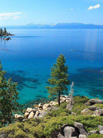
The Wild Atlantic Way is one of those road trips people talk about long after they get home. It runs along Ireland’s west coast, packed with sea views, small towns, and wide open stretches of road. In this guide, we’ll talk about the 13 stops on the Wild Atlantic Way to help you plan a trip that feels relaxed but still full of standout moments.
This route is great for slow travel. Some days are packed with big views and famous landmarks. Other days are quiet and simple, with nothing but sea air and the sound of waves. That’s part of what makes it special. It’s not about rushing from place to place. It’s about the drive, the stops, and the stories you pick up along the way. If you’re planning a trip, this guide will help you get started.
Slieve League Cliffs (Donegal)
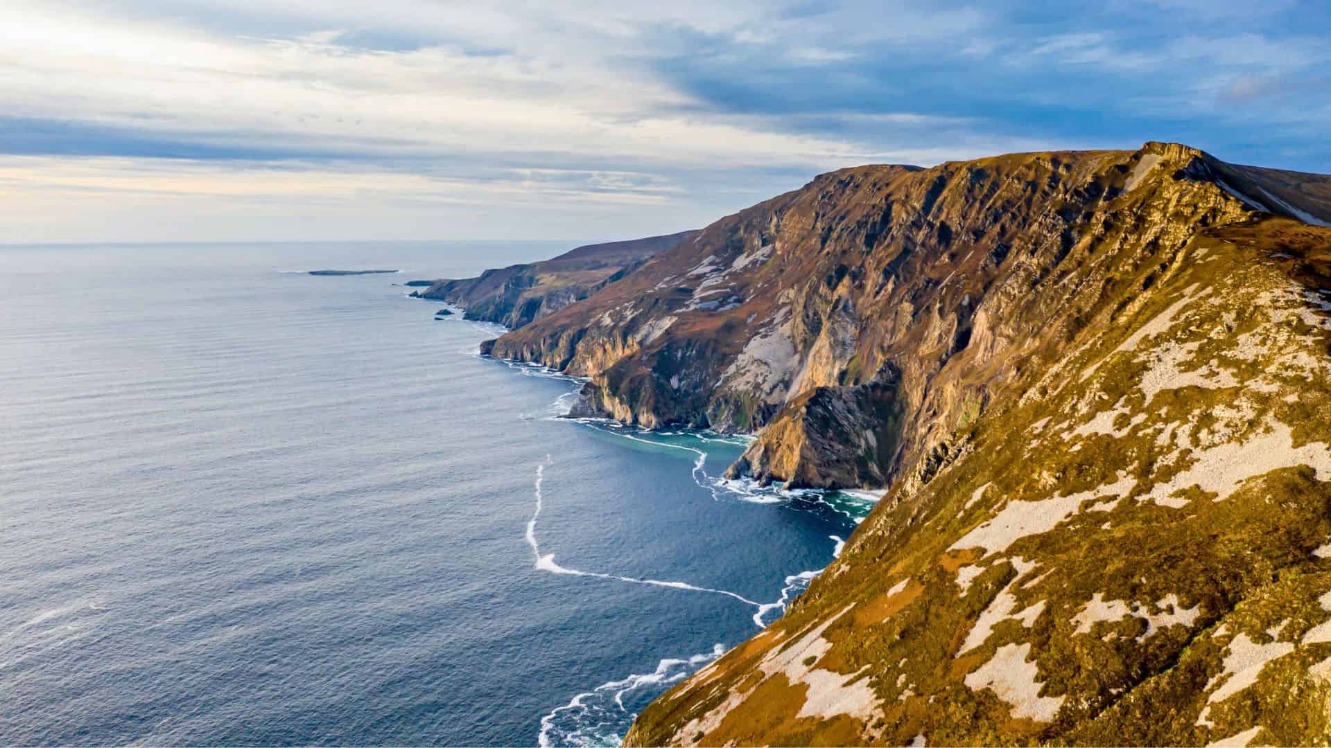
Slieve League Cliffs rise dramatically from the Atlantic, reaching heights of nearly 2,000 feet, making them among the tallest sea cliffs in Europe. The scale of the landscape feels vast and untamed, with sheer rock faces plunging into restless waters below. A narrow road leads toward Bunglass Point, while hiking trails such as the One Man’s Pass challenge confident walkers with steep drops and sweeping views. On clear days, the horizon stretches endlessly across ocean and sky. Compared to more crowded cliff sites in Ireland, this remote corner of Donegal feels raw, powerful, and deeply connected to nature.
Malin Head (Donegal)
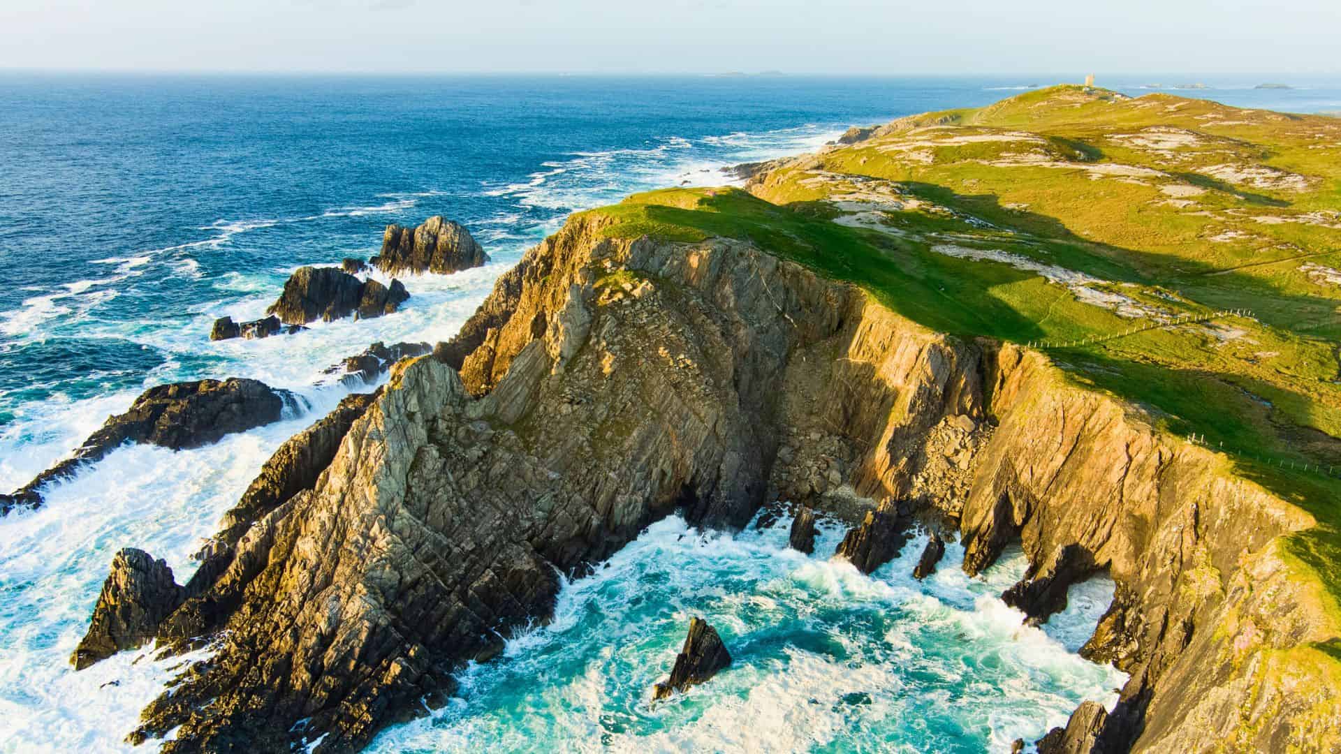
Malin Head marks Ireland’s northernmost point, where the Inishowen Peninsula meets the Atlantic in dramatic fashion. The coastline is carved by wind and waves, forming jagged rock formations, natural arches, and tidal pools. Banba’s Crown, crowned with a historic Napoleonic signal tower, stands as a key viewpoint overlooking endless sea routes once watched for approaching ships. The area gained international attention as a filming location for Star Wars, yet it retains a remote, elemental character. Stormy weather transforms the headland into a spectacle of crashing surf, while calmer days reveal distant Scottish islands across the water.
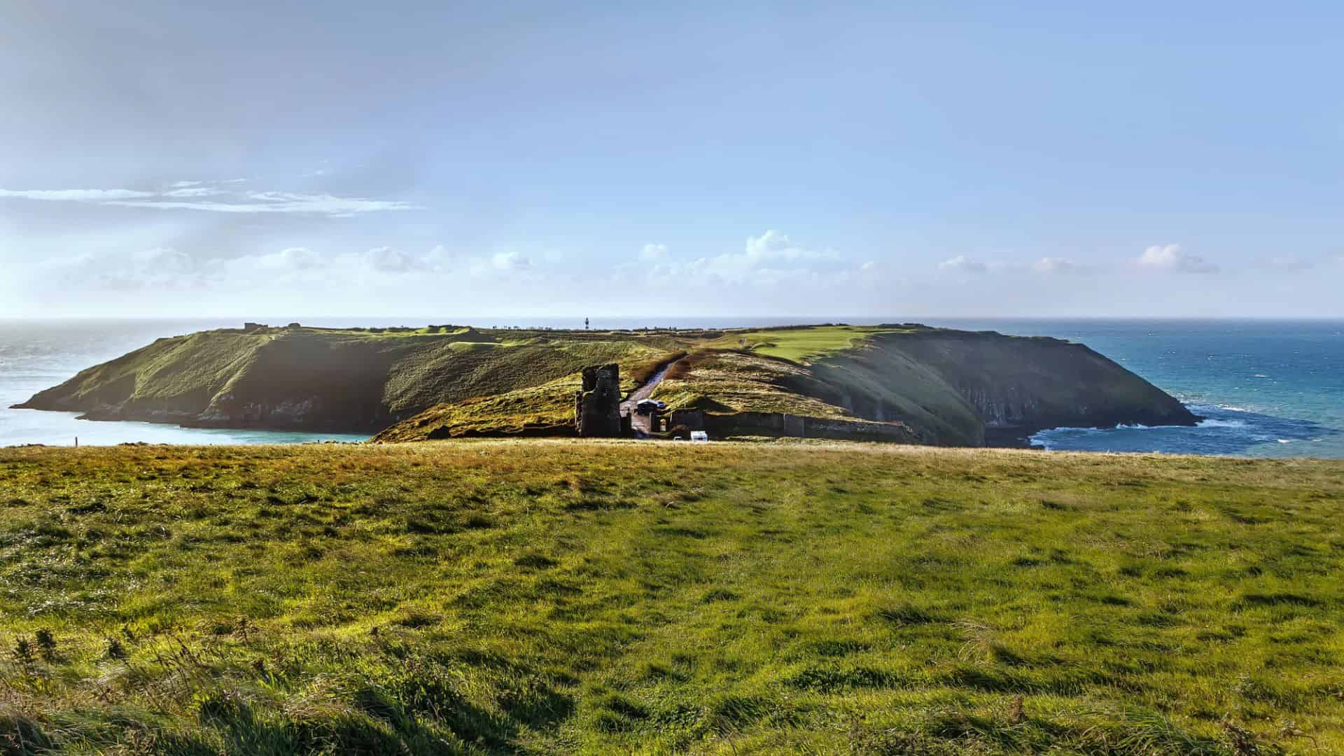
Downpatrick Head (Mayo)
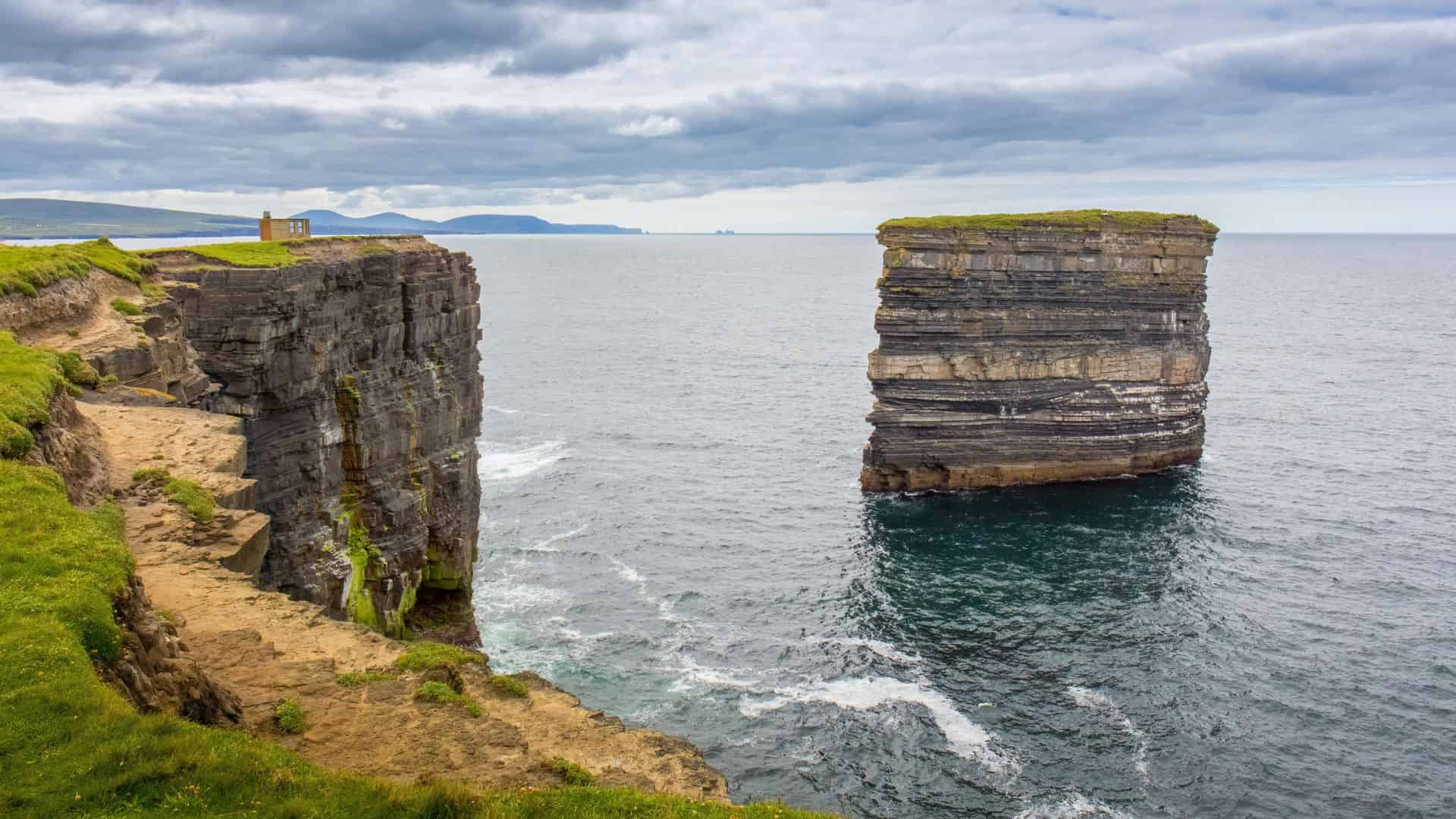
Downpatrick Head stretches boldly into the Atlantic from County Mayo, shaped by centuries of erosion and Atlantic storms. The towering sea stack known as Dún Briste stands just offshore, isolated from the mainland since the seventeenth century. Visitors can walk along cliff-top paths where blowholes send bursts of seawater high into the air during rough conditions. The site also holds links to St. Patrick, with ruins of a small church and a stone cross nearby. Grass-covered fields contrast sharply with dark rock faces and churning ocean, creating a scene that feels both historic and elemental.
Achill Island (Mayo)
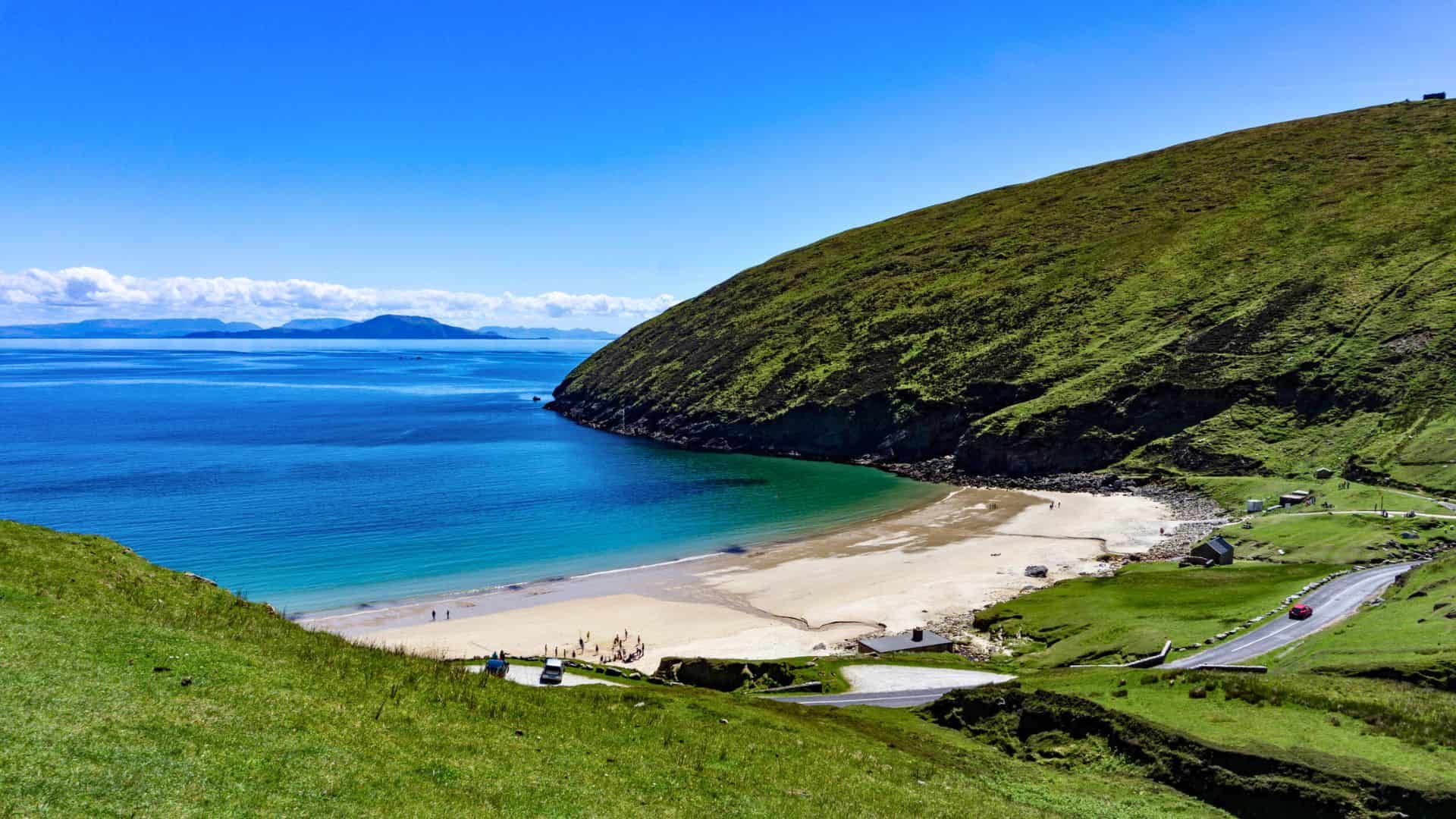
Achill Island, connected to the mainland by bridge, is known for its sweeping beaches, rugged hills, and open Atlantic views. Keem Bay curves in a near-perfect horseshoe, framed by steep green slopes and turquoise water. The Atlantic Drive circles much of the island, revealing cliffs, boglands, and quiet stretches of shoreline. Outdoor enthusiasts can hike Croaghaun, whose northern slopes drop dramatically toward the sea, or explore the abandoned Deserted Village at Slievemore. Changing light and fast-moving clouds transform the landscape throughout the day, creating a setting that feels expansive and deeply rooted in tradition.
Kylemore Abbey (Galway)
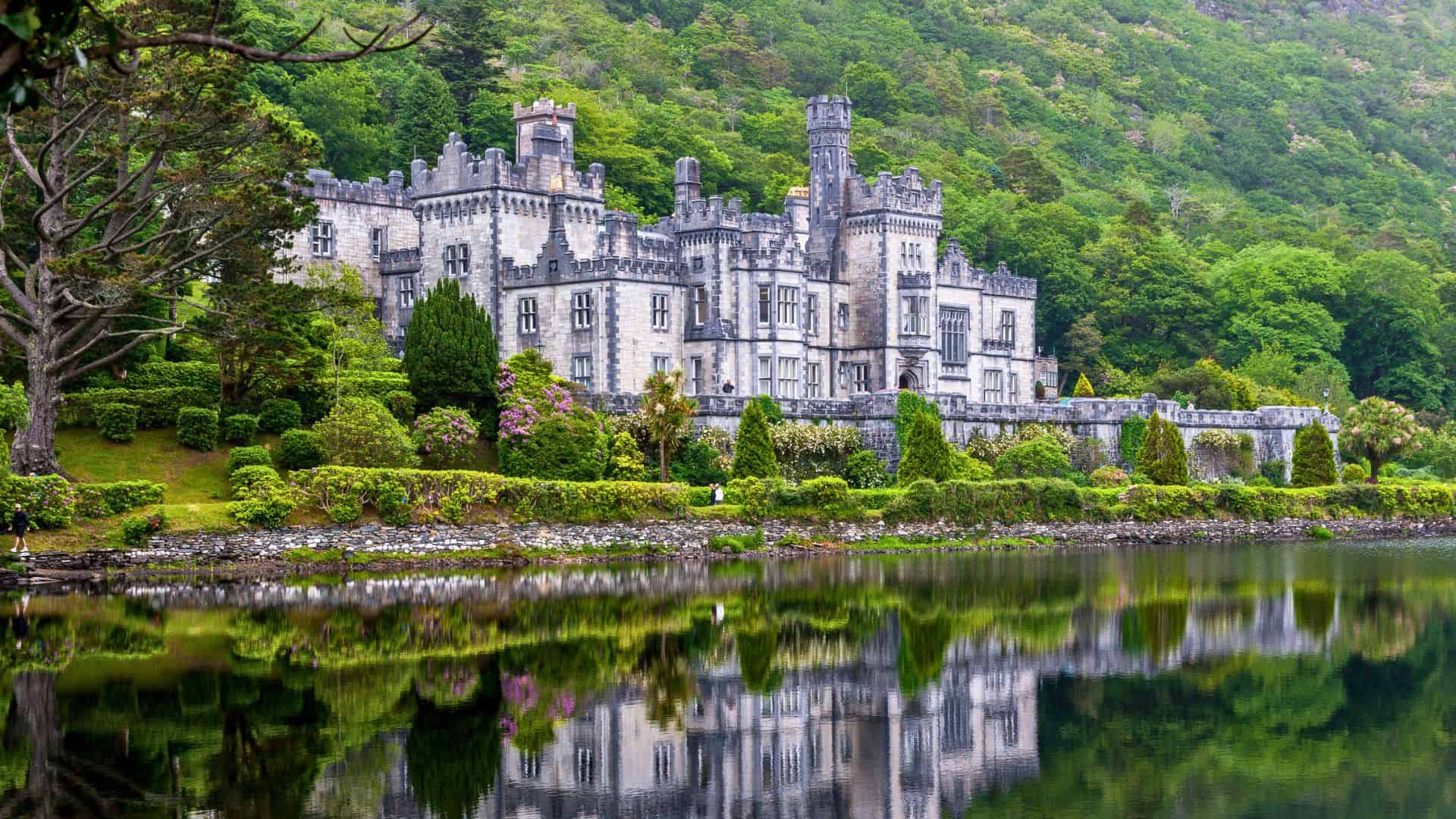
Kylemore Abbey sits at the edge of a reflective lake in Connemara, backed by the rugged slopes of the Twelve Bens. Originally built in the nineteenth century as a private castle, it later became home to a Benedictine community. Its grey stone façade and turrets create a striking contrast against the surrounding woodland and mountain scenery. Visitors can explore restored period rooms, a Gothic church, and carefully maintained Victorian walled gardens. Mist often drifts across the water in the morning, adding a quiet, contemplative atmosphere to the grounds and highlighting the harmony between architecture and landscape.
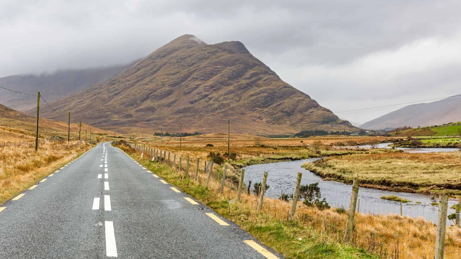
Connemara National Park (Galway)
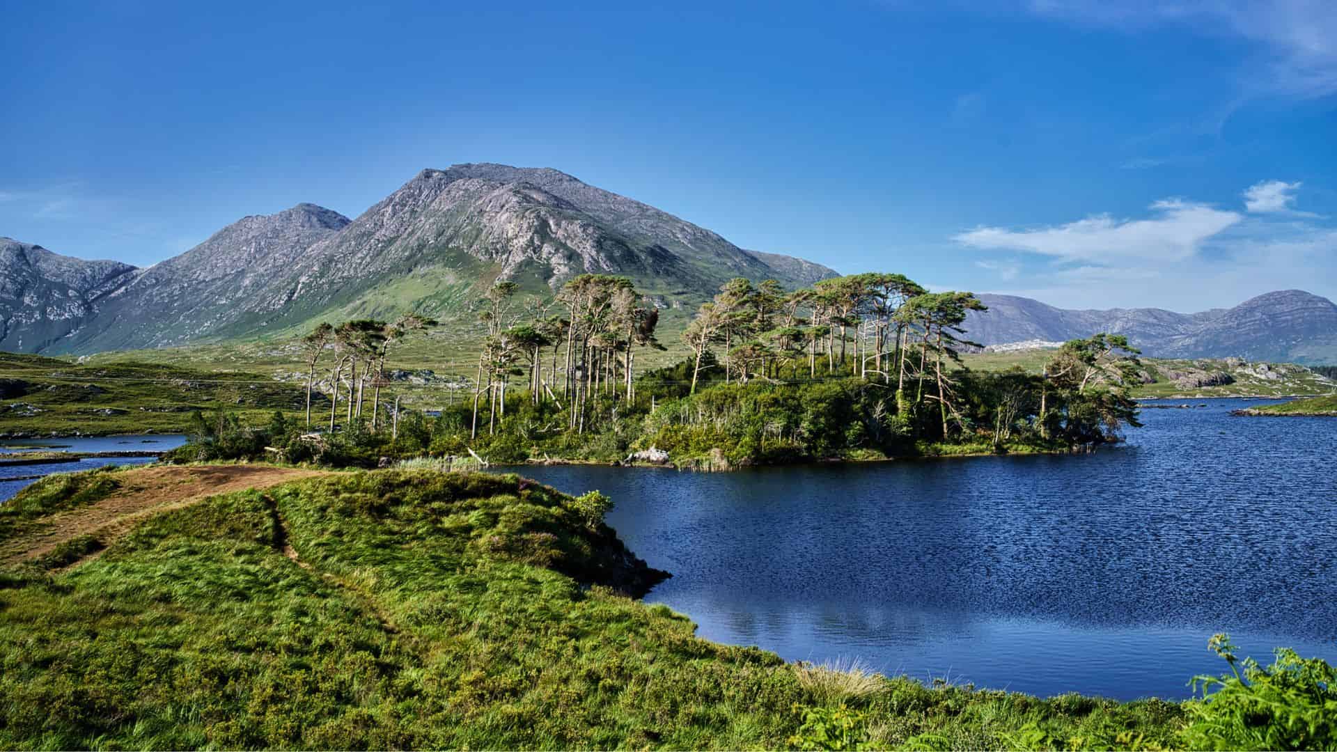
Connemara National Park spans nearly 3,000 hectares of mountains, bogs, heaths, and grasslands in northwest Galway. The park is home to the Twelve Bens mountain range, whose quartzite peaks rise sharply above a patchwork of moorland and lakes. Well-marked trails lead visitors through varied terrain, from gentle woodland walks to the summit path up Diamond Hill, where panoramic views stretch across the Atlantic coastline and offshore islands. Native wildlife such as Connemara ponies and red deer roam the landscape. Changing weather moves swiftly across the region, casting shifting light over this rugged and expansive terrain.
Cliffs of Moher (Clare)
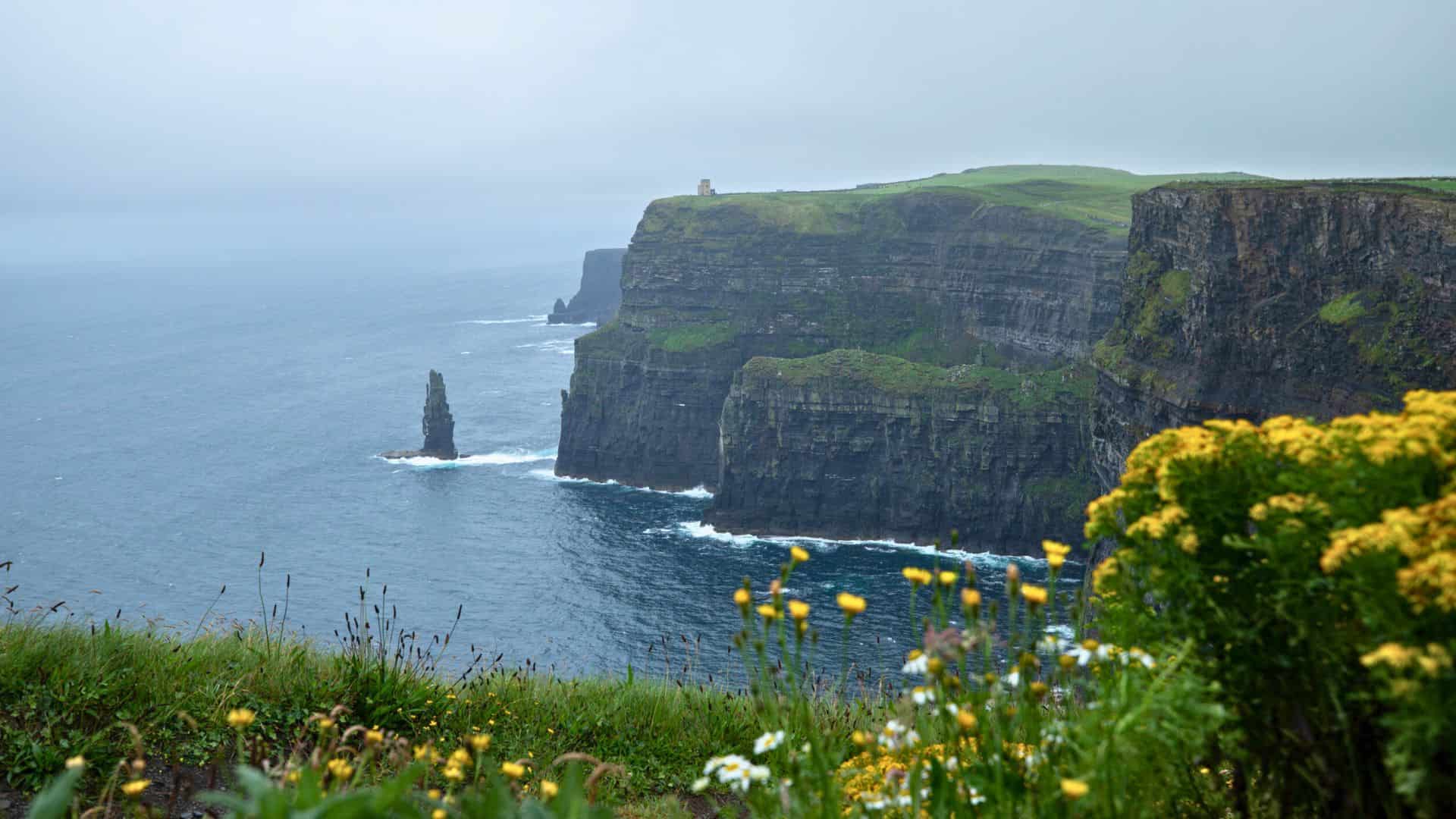
The Cliffs of Moher extend for about eight miles along County Clare’s Atlantic coast, rising to heights of more than 700 feet at their tallest point. Layers of shale and sandstone form dramatic vertical faces that drop straight into crashing waves below. O’Brien’s Tower, built in the nineteenth century, stands near the highest section and serves as a prominent viewpoint. Seabirds such as puffins, razorbills, and guillemots nest along the cliff ledges, creating a lively spectacle during breeding season. On clear days, the Aran Islands and distant mountains appear across the horizon.
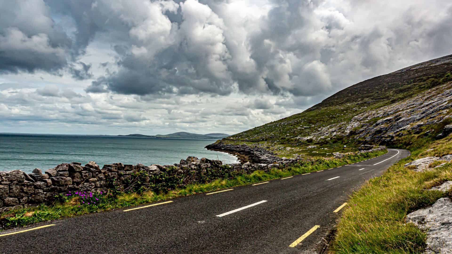
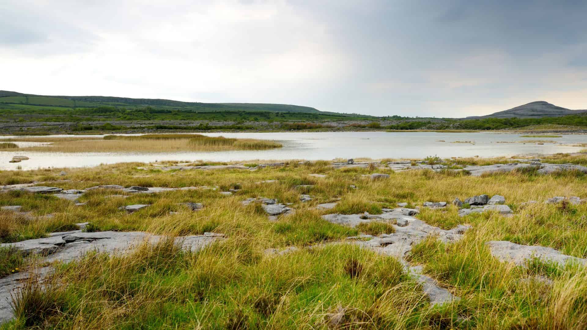
The Burren (Clare)
Want to save this?
The Burren is a striking limestone region shaped by ancient seas and glacial activity, covering much of northern County Clare. Its cracked stone pavements form a vast network of fissures known as grikes, where wildflowers bloom in spring and summer. Despite the stark appearance, the area supports a wide variety of plant life, including species typically found in Arctic and Mediterranean climates. Archaeological sites such as Poulnabrone Dolmen and Caherconnell Stone Fort reveal human settlement dating back thousands of years. Beneath the surface, cave systems wind through the rock, adding further depth to this remarkable landscape.
Dingle Peninsula (Kerry)
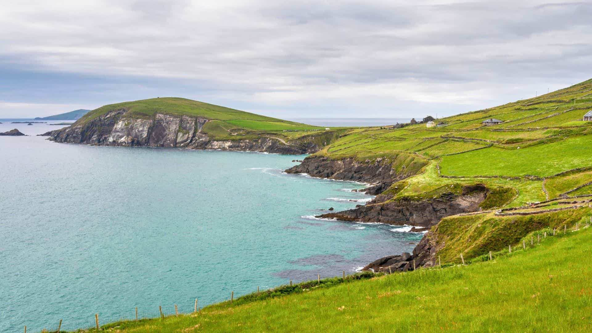
The Dingle Peninsula stretches into the Atlantic with a coastline defined by cliffs, sandy beaches, and rolling green hills. Slea Head Drive circles the western edge, revealing views of the Blasket Islands and early Christian stone huts perched above the sea. The peninsula carries a strong Irish-speaking tradition, with cultural heritage visible in place names and local customs. Dingle town forms the lively heart of the region, known for its colorful harbor and active fishing fleet. Inland, Mount Brandon rises prominently, drawing hikers seeking sweeping views across the ocean and the countryside.
Skellig Michael (Kerry)

Skellig Michael rises sharply from the Atlantic about twelve kilometers off the Kerry coast, its twin peaks visible from the mainland on clear days. This rocky island became home to a small monastic settlement in the sixth century, where stone beehive huts and narrow terraces still cling to steep slopes. Reaching the summit requires climbing hundreds of ancient stone steps carved into the rock. Atlantic seabirds, including gannets and puffins, circle overhead during nesting season. Recognized as a UNESCO World Heritage Site, the island carries a powerful sense of isolation shaped by wind, sea, and centuries of devotion.
Ring of Kerry (Kerry)
The Ring of Kerry is a circular driving route of about 179 kilometers that loops around the Iveragh Peninsula. Along the way, travelers encounter shifting scenery that ranges from rugged coastline to inland lakes and mountain passes. Killarney National Park forms a central highlight, with Muckross House and the Lakes of Killarney framed by wooded hills. Small towns such as Kenmare, Sneem, and Cahersiveen punctuate the route with colorful streets and harbors. Stone forts, standing stones, and sweeping Atlantic views connect the journey to layers of history and landscape across southwest Ireland.
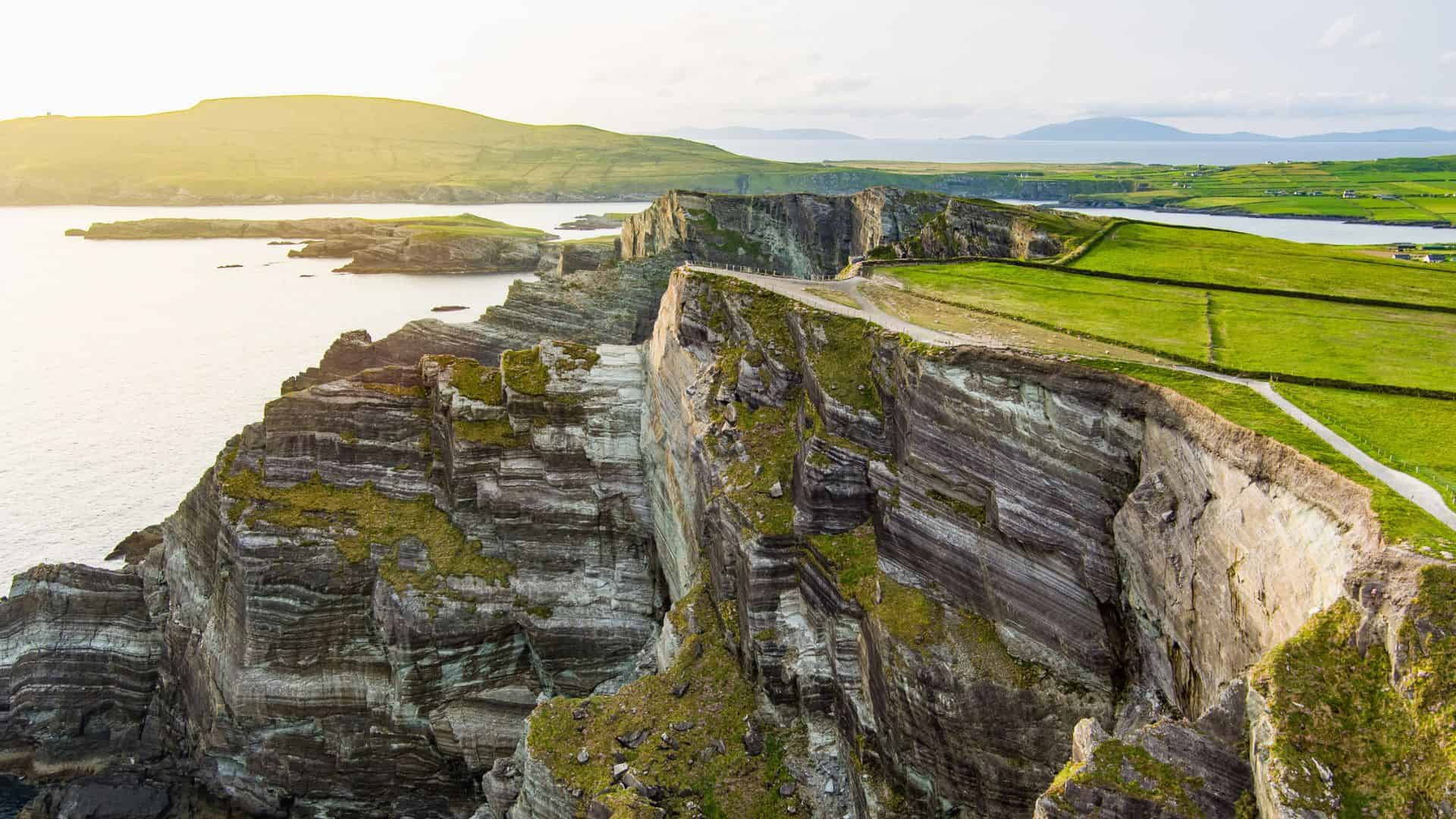
Mizen Head (Cork)
Mizen Head marks the southwestern edge of mainland Ireland, where steep cliffs descend toward powerful Atlantic swells. A narrow footbridge spans a deep chasm, leading visitors to a signal station that once guided ships through hazardous waters. Interpretive displays recount stories of maritime rescues and lighthouse keepers who worked in challenging conditions. The surrounding coastline features jagged rock formations, seabird colonies, and dramatic wave action during stormy weather. Clear days reveal the distant Fastnet Rock Lighthouse on the horizon, a landmark long associated with ocean racing and transatlantic voyages.
Kinsale (Cork)
Kinsale sits at the mouth of the River Bandon, its harbor lined with sailboats and historic buildings painted in bright colors. The town has long held strategic importance, reflected in the star-shaped Charles Fort and nearby James Fort guarding the entrance to the harbor. Narrow streets weave between galleries, shops, and traditional pubs, creating a lively maritime atmosphere. Coastal walks lead from the town toward Scilly and along headlands with views back across the water. Layers of history, from medieval trade to the Battle of Kinsale, remain visible throughout this vibrant seaside setting.
Chase the Coast
The Wild Atlantic Way isn’t the kind of trip you rush through. It’s better when you take your time, stop often, and stay flexible. These 13 stops on the Wild Atlantic Way give you a strong starting point, whether you have a few days or a full week to explore. You can map everything out, or just pick a direction and see where the road leads.
What makes this route great is how easy it is to shape it around your own pace. Some travelers chase big coastal views, others lean toward quiet towns and long walks. There’s no single right way to do it. Pack a rain jacket, keep your camera close, and don’t be afraid to take the long way around.
10 Beautiful Riverside Cities in Europe for Scenic Walks and Views
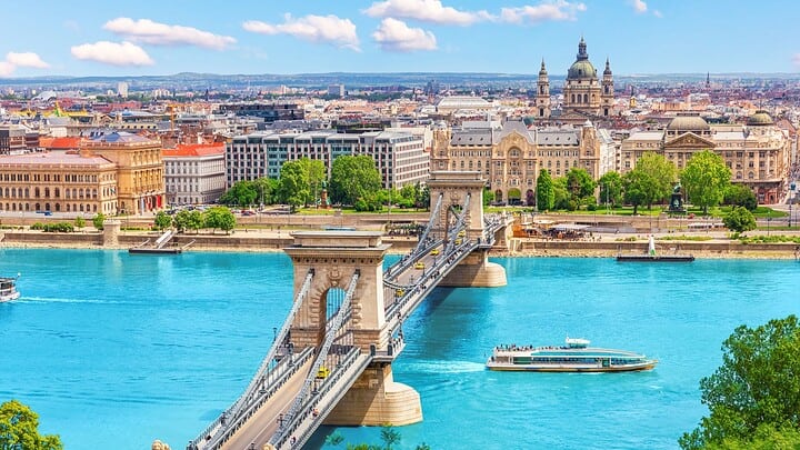
There’s something about a city built along a river that just works. The water adds space, light, and a natural path through the streets. It shapes where people gather, where bridges rise, and where the skyline makes its biggest statement. There are 10 beautiful riverside cities in Europe that still draw locals and visitors to their banks. Here, early mornings feel calm and clear, while evenings bring reflections of towers, domes, and streetlights across the surface.
Read More Here: 10 Beautiful Riverside Cities in Europe for Scenic Walks and Views
10 Most Picturesque Fishing Villages in the British Isles
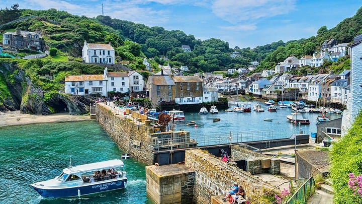
Forget the crowded tourist traps and the loud city centers for a second. If you really want to see 10 fishing villages in the British Isles, you have to head toward the coast. There is something great about a place where the tide dictates the schedule and the salt air hits your face the second you step out of the car. These spots aren't just pretty backdrops for a photo. They are real, working places where people have pulled nets from the sea for hundreds of years.
Read More Here: 10 Most Picturesque Fishing Villages in the British Isles


Leave a Reply